Introduction
What is Charts?Read the “What is Charts?” section
Navigraph offers Airport Charts, provided by Jeppesen, which describe how to fly to and from an airport, and Enroute Charts, which describe how to fly between airports. Both are offered in the Navigraph Charts software together with additional functionality to sort and organize the charts, for instance in preparation for a flight.
The functions described above are available via the Charts API. This API are typically used by addon software running inside the flight simulator to display charts on the virtual flight deck as an Electronic Flight Bag (EFB).
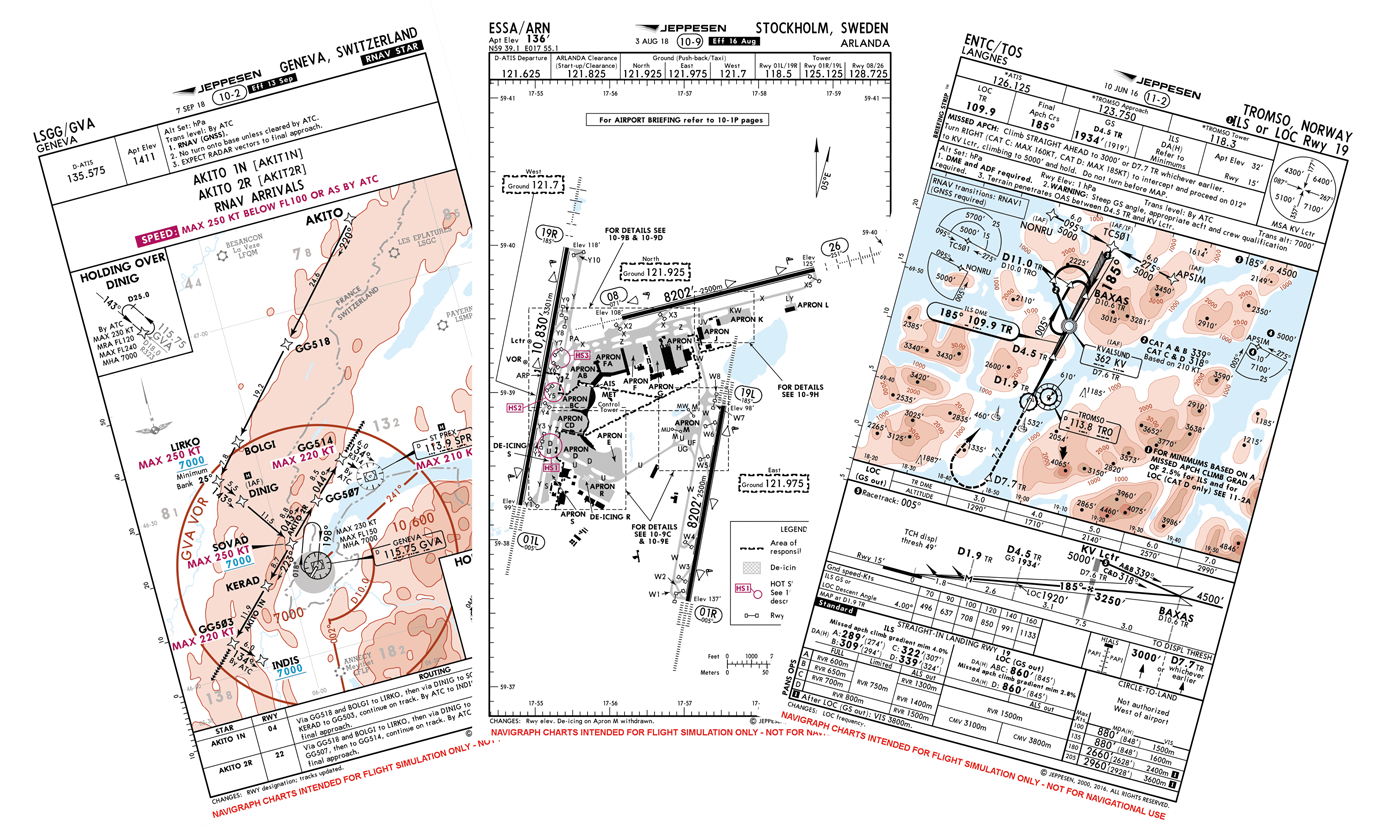
The Airport Charts include Standard Instrument Departure (SID), Standard Terminal Arrival Route (STAR), Approach Procedures (APP), Taxi Diagrams (TAXI), and Reference Documents (REF). They come in two contrast versions, for day and night, and in two modes, Standard Instrument Flight Rules (IFR) and Commercial Airline Overlay (CAO). The main difference between the two is that CAO has is optimized for airliner (cat C/D aircraft) operations.
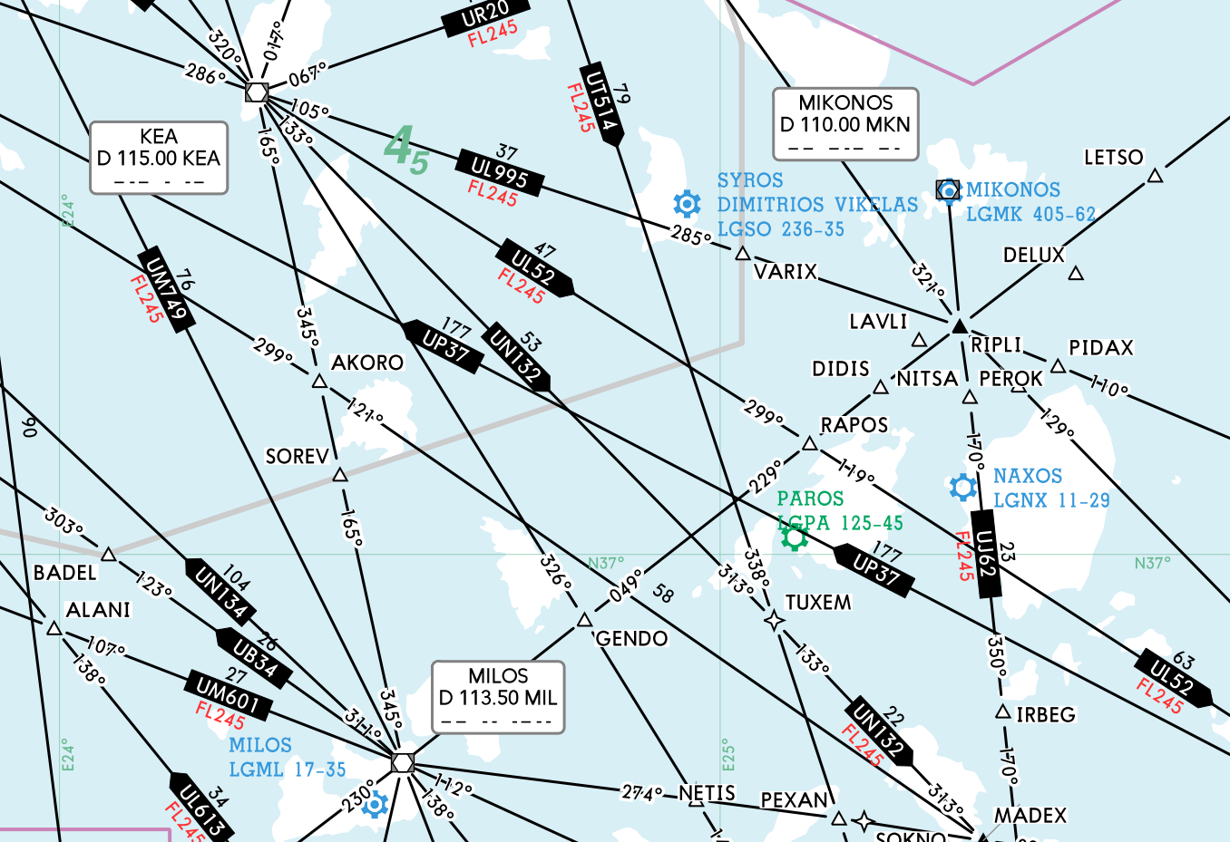
The Enroute Chart is rendered by Navigraph from Jeppesen NavData™ into eleven zoom levels of rasterized tiles, upper and lower airways, hosted on Amazon Web Service S3 buckets in several locations around the world for low latency. The rasterized tiles have a low performance impact and are quickly loaded also by slightly older devices.
The charts are provided by Jeppesen, and are updated according to the AIRAC cycle every 28 days. It is the largest and most comprehensive database of its kind, with over 7,000 airports covered in 230 countries and territories worldwide.